t-mts logo

T-MTS 5.0 - better on tour

T-MTS 5.0 stands for the optimized version of the popular tool T-MTS, developed by the tool professional MTS. It is intuitional, data can easily be inserted and it is responsive on all mobile devices. T-MTS makes it possible to visualize tour data on different websites without re-inserting data. An advantage for users and suppliers - T-MTS users remain on YOUR website.

Handling

Handling

The touring tool can easily be handled, as the backend for inserting data is very intuitional. All inserted data are illustrated in a user-friendly way and can also be used for other sites, whitout re-inserting the information.

Data input

Data input

For inserting or correcting data, there is an intuitional backend. GPS tracks or GPS points as well as pictures are automatically saved and descriptions as well as highlights/waypoints can easily be inserted. Information regarding the elevation profile or hights are automatically generated by the tool and illustrated in an addressing manner. 

Clearly arranged

Clearly arranged

Tours can be assigned to categories, the level of difficulty is distinguished with colours and visible at first sight. Altitude profiles, information about km, ascent in percent and density of traffic in realtime are also illustrated. Moreover the new T-MTS version puts more emphasis on highlights, that is to say waypoints, and a keyword waypoint search is possible.

Extendible

Extendible

Users are not redirected to another portal and keywords of the content generate traffic on your website. Tours can be published on more domains. One data input, multiple presentation. Low effort, maximum efficiency.

Download

Download

All common GPS data formats on the market are supported. A detailled pdf tour description can be printed as orientation guide on tour. A huge advantage not only for the guest, but also for you as provider, as in this way you can create a tour folder with all your personal tours and show it to interested guests in the reception.

Features

  • simple handling
  • intuitional data input
  • 100% responsive integration on the current website
  • shortest load time
  • comprehensive search function
  • tours can be classified
  • level of difficulty is marked with different colours
  • distance marker and altitude profile with gradient in %
  • possibility to download and print tours as pdf file
  • illustration of tours on street map, saltellite map, open country, detailled map, cycling and hiking paths, nature map, bus and train maps
  • street view
  • tour weather refreshed on a regular basis 
  • available in different languages
  • selected tours can be locked
  • tours can be unlocked by code after a completed booking
  • extension for secure server connections (https)

Interested?
Don't hesitate to contact us for questions or advice.  

One data input - multiple publication

In the editor of T-MTS the tour supplier can easily insert all data and information relevant to a tour, including also highlights, that is to say waypoints. Tour information can be inserted in more languages and can be corrected or changed any time. The T-MTS backend provides an overview on the personal archives as well as tours that are still available. Very easy is also the creation of a new tour in more languages. By the way, once a tour is inserted it can be published on different sites.

  • Overview tours
    ipad-frame

    Overview tours

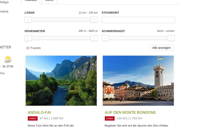
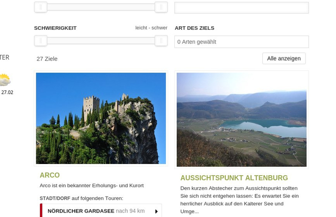
    This view provides an overview of the tours and also shows the level of difficulty, length in km, altitude difference and a short description. The tours can be filtered by length, metres of altitude or difficulty and there is a keyword search function.

  • Overview waypoints
    ipad-frame

    Overview waypoints

    Waypoints or highlights, that is to say viewpoints, cities, museums or other highlights, must be inserted in every tour. This view shows tours listed according to waypoints and you can see which tours leads to each highlight and how difficult and long the respective route is. The tours can be filtered by distance, difficulty, keywords or type of waypoint.

  • Detailled tour description
    ipad-frame

    Detailled tour description

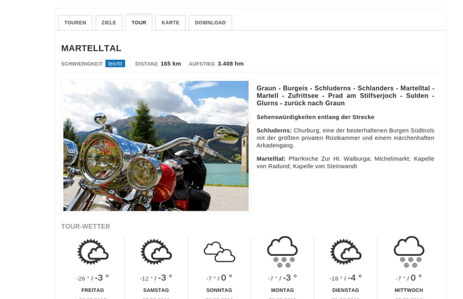
    A detailed tour description with eye-catching picture, information regarding difficulty, distance, altitude difference and notes about highlights on this tour are available in the detailed tour description. This is also where you find the tour weather forecast, refreshed on a regular basis.

  • Download
    ipad-frame

    Download

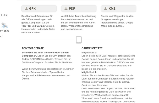
    In the download area you can see in which tour you are. This is where you can download the tour on any common device. Moreover you get the possibility to print the tours as pdf file and to take the information on tour. As a supplier in the tourism sector you can easily create a tour map that you can offer to your guests in the reception or rooms. A service that distinguishes you.

  • Map
    ipad-frame

    Map

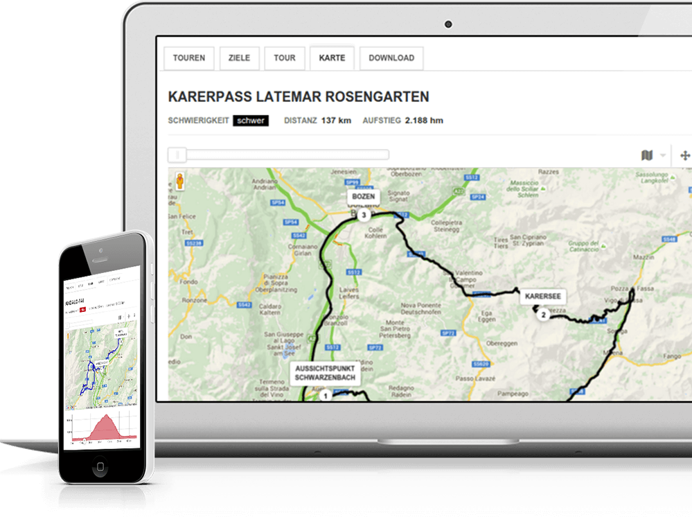
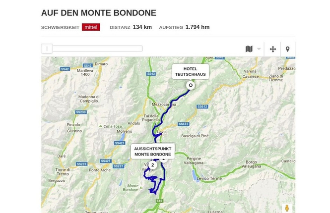
    The GPS track and the highlights of the tour are shown on the map as well as on the altitude profile. Moreover it illustrates the position of the supplier. These points, however, can also be masked out. There are different views you can choose in the map, such as detailled view, street view, open country, cycling paths and walking trails, nature view, bus and trains. The altitude profile shows the walked km, the gradient in percent as well as kilometres. By clicking on a waypoint you get further information about the highlight.

  • Altitude profile
    ipad-frame

    Altitude profile

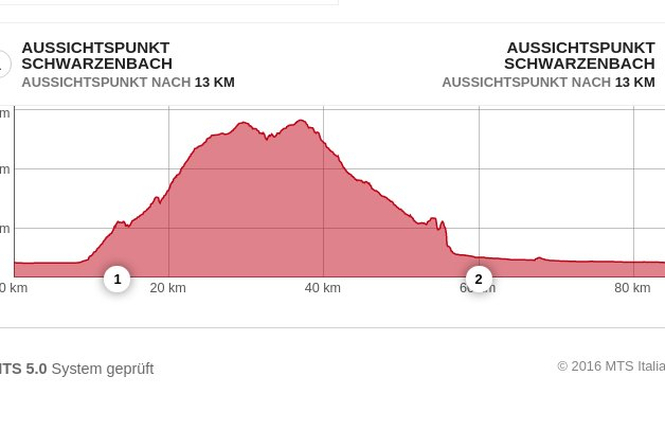
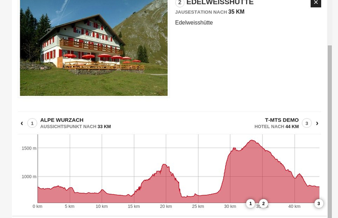
    The altitude profile is available in the tour detail view below the map and reveals information on the metres in altitude that have already been walked, as well as on the distances. It also shows the gradient in percent, which is particularly interesting for roadbikers. Also highlights that have been entered for this tour are displayed. By clicking on the waypoints in the profile, detailed information is shown.

  • Intuitional data input
    ipad-frame

    Intuitional data input

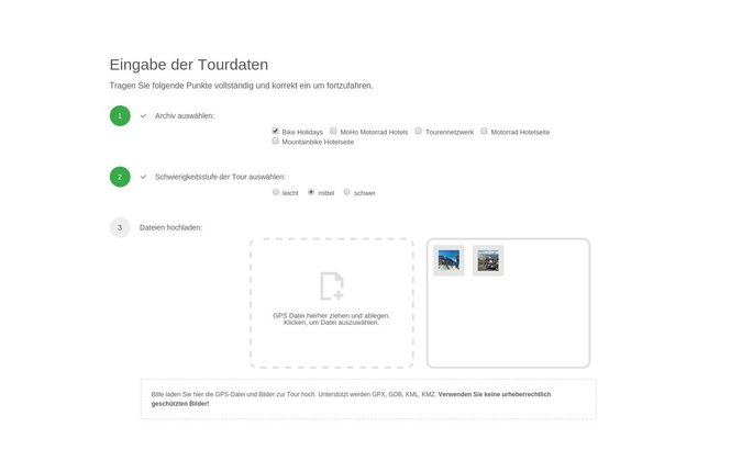
    The input of data is done step by step, if one step is completed you are automatically led to the next. The green button tells you that the information is complete, the orange that you can proceed but it might be advantageous to add more information. An inactive button tells you that not all information needed has been inserted. The tour archive is your personal collection, your personal tool. Once the data is inserted, you can multiply use it on other sites.

  • Waypoints in the altitude profile
    ipad-frame

    Waypoints in the altitude profile

    The altutide profile, which is automatically generated, shows the gradient in percent, information about distances and the inserted highlights along the course of the tour. By clicking on the waypoint more information about these highlights are shown.

  • Locked tours
    ipad-frame

    Locked tours

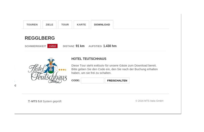
    As supplier you have the possibility to lock certain tours and to unlock the information by code after a booking. When booking, the guest gets a code which makes him unlock the information, so that he can also download and print the pdf file. Another incentive for booking your accommodation.

© 2024 MTS Italia GmbH

Never has tour planning been so easy -

T-MTS 5.0 makes the difference

MTS

MTS

tofisch I villa I verde Anton Peintner Str. Nr. 4 39030 Vintl Italy

Tel: +39 0472 869368

Activation and request